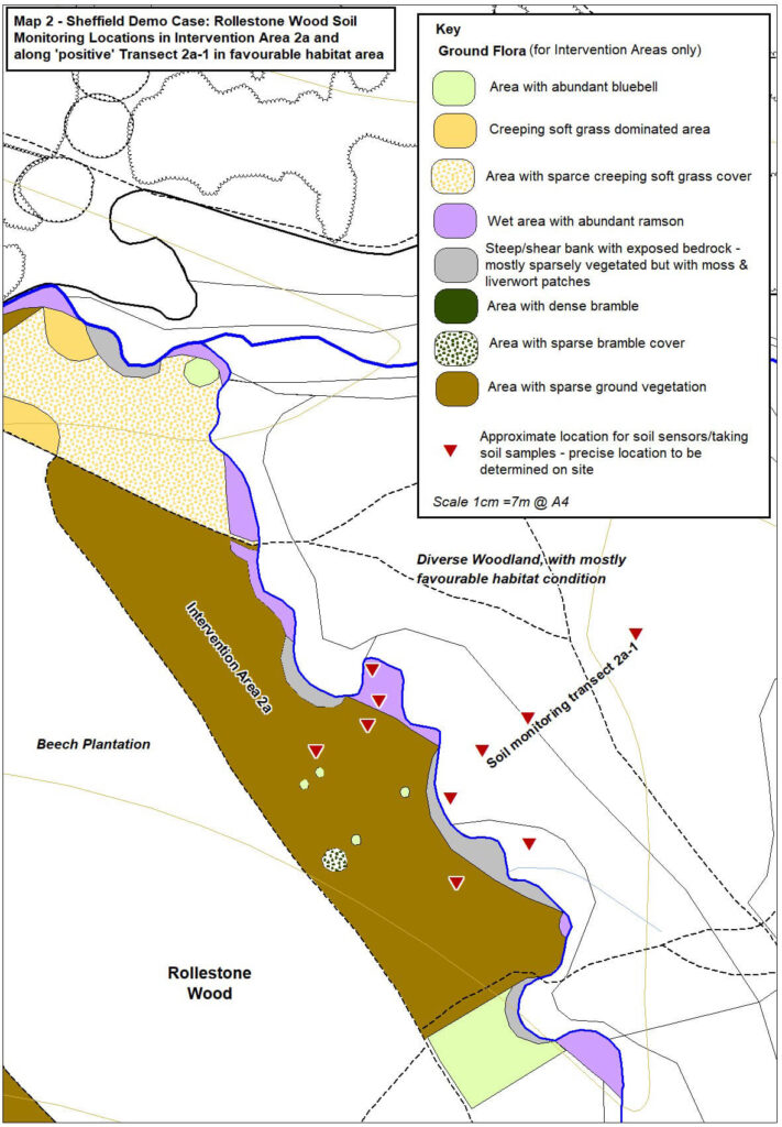
The map above shows the intervention area for the InNature project, where habitat and restoration and access improvements are to be undertaken, and ‘reference areas’, where no intervention is being undertaken. This report follows on from our earlier post about the InNature project activity with Regather and the Gleadless Valley Wildlife Trust (GVWT) in Rollestone Woods in the Gleadless Valley, where the streamside and central Intervention Areas 2a & 2b in the beech area of the wood were visited. Please read this project overview post to understand the background to the project and the reasons for working in the Gleadless Valley.
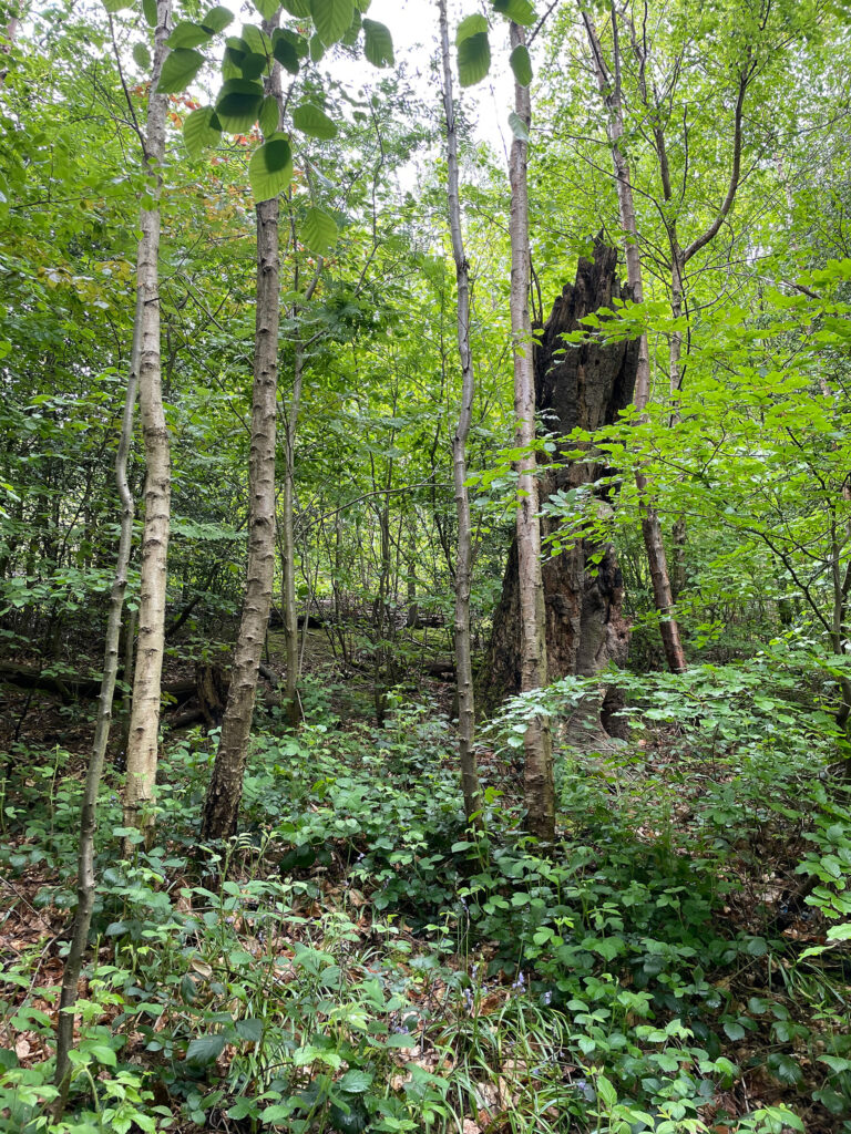
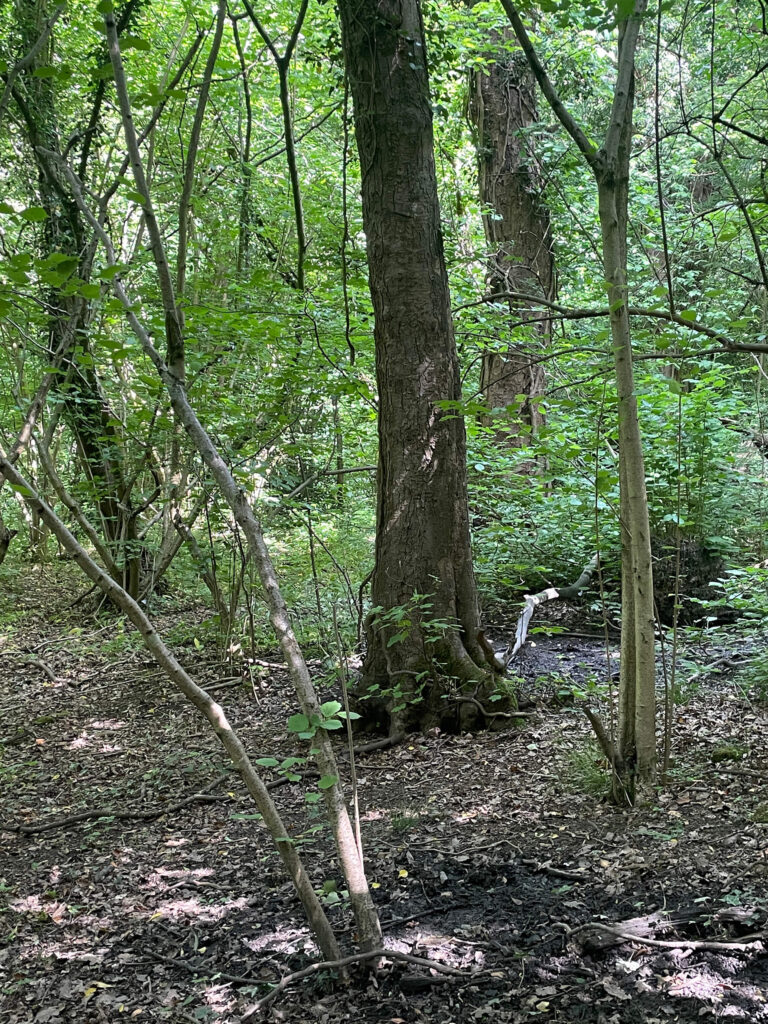
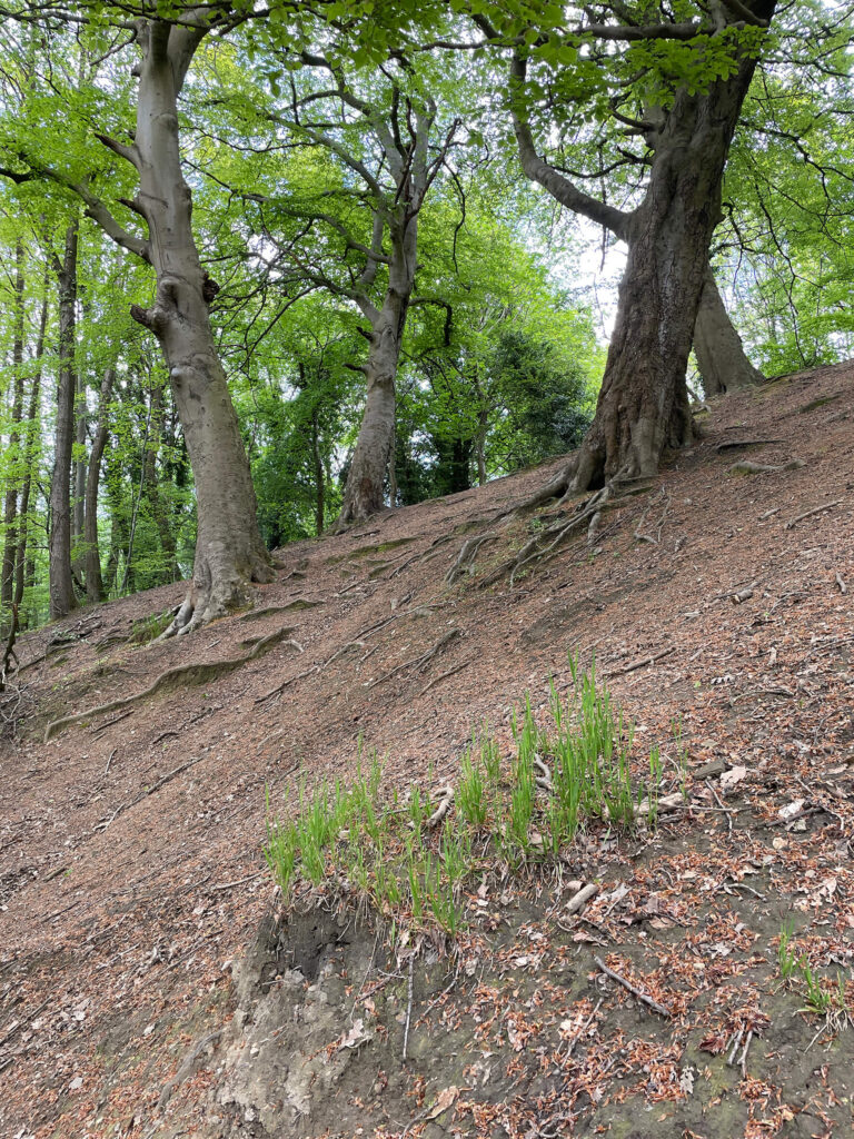
We visited Rollestone Wood to see the beech plantation ‘reference area’ 2d where no active woodland management is planned. This acts as a ‘control’ to compare and contrast with the similar intervention areas 2a & 2b where the project activity is taking place. The reference area is chosen to be as similar as possible to the other areas so as to better demonstrate the results of our interventions. The hoped for outcome of which is to see both greater diversity of groundflora species and increased numbers of these individual species, along with increased young tree regeneration.
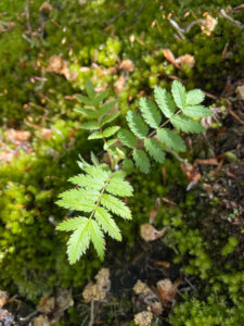
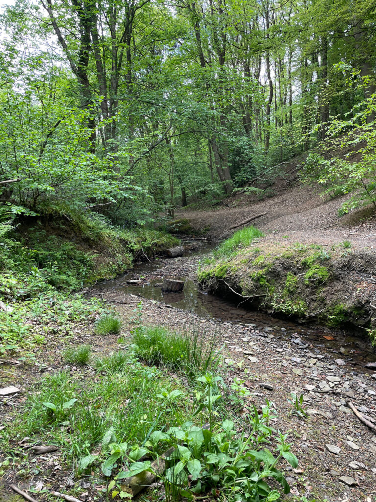
In early May, we undertook a visual survey of the Rollestone Wood coppice intervention area 2c, situated on the steep valley side running down to the valley bottom of a tributary stream of the Meers Brook.. May is the best time to see the extent of the wildflowers that enjoy this damp streamside habitat. We also observed a mini understory forest of broad buckler ferns, Dryopteris dilatata, that may be ancient plants, despite their diminutive size.
Directly above this streamside area, we walked up a steep slope that just a couple of hundred years ago was humming with industry. Almost impossible to make out now, especially to the untrained eye, we passed a flattened area that once supported a charcoal hearth. The hillside above this still bears the scars of this human activity. Here the grass turf was stripped and used to cover the slow burning fires that produced charcoal to power Sheffield’s metal industry. The result is heavily eroded soils and this is where the GVWT are using Nature Based Solutions (NBS) to rebuild the soil layer. Preventing soil erosion is key to reducing downstream flood risk by preventing watercourses from narrowing due to a build up of silt.
We also visited the Carr Wood coppice intervention areas 1b, the only surviving area of relict hazel coppice in the Gleadless Valley. Coppiced hazel, Corylus avellana. formed a vital component of the economic activity within the woods, with records of a woodland here dating back as far as 1583. The coppiced hazel has long since fallen out of use and some ‘stools’ – the bases from which the ‘poles’ resprout after cutting – have grown to an impressive size and are in good health. Whereas other hazel stools suffer from being overshadowed by sycamore, Acer pseudoplatanus. Work will be undertaken to remove the sycamore and encourage natural regeneration.
Further up the stream in Carr Wood, there is a botanical highlight: an undisturbed wildflower bank hosting ancient woodland indicator species. This small fragment hints at the great floral diversity that once thrived here. Nearby this spot an extreme example of a slope denuded of almost all vegetation can be seen. Where beech, Fagus sylvatica, trees were planted, the understory vegetation disappeared leaving bare earth where soil has eroded back to expose tree roots. These roots are now the only thing preventing the slope from slipping into the brook during a heavy rainfall event. A severe case such as this demonstrates the value of the NBS interventions taking place in Rollestone Wood.
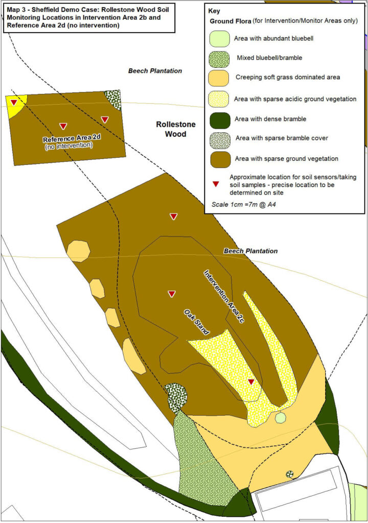
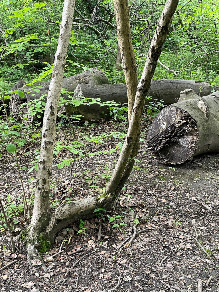
This area of woodland has been designated as the control area because it shares the same conditions as the areas of woodland 2a & 2b with a closed beech canopy. Consequently the ground is mostly bare, except for a few seedlings and saplings of beech; hawthorn, Crataegus monogyna; and sycamore; plus small patches of moss and creeping soft grass, Holcus mollis, in places.
On the edges of this closed canopy there are two open glades where there is enough light for a greater variety and quantity of tree regeneration. In the first glade the following saplings are present: ash, Fraxineus excelsior, (with ash dieback); rowan, Sorbus aucuparia; beech, with bramble, Rubus fruitcosus growing underneath.
In the second glade there is a more extensive patch of soft grass, which lies between the beech canopy edge and a stand of oak, Quercus petraea. This patch of regenerating woodland also includes some sweet chestnut, Castanea sativa; holly, Ilex aquifolium and beech saplings.

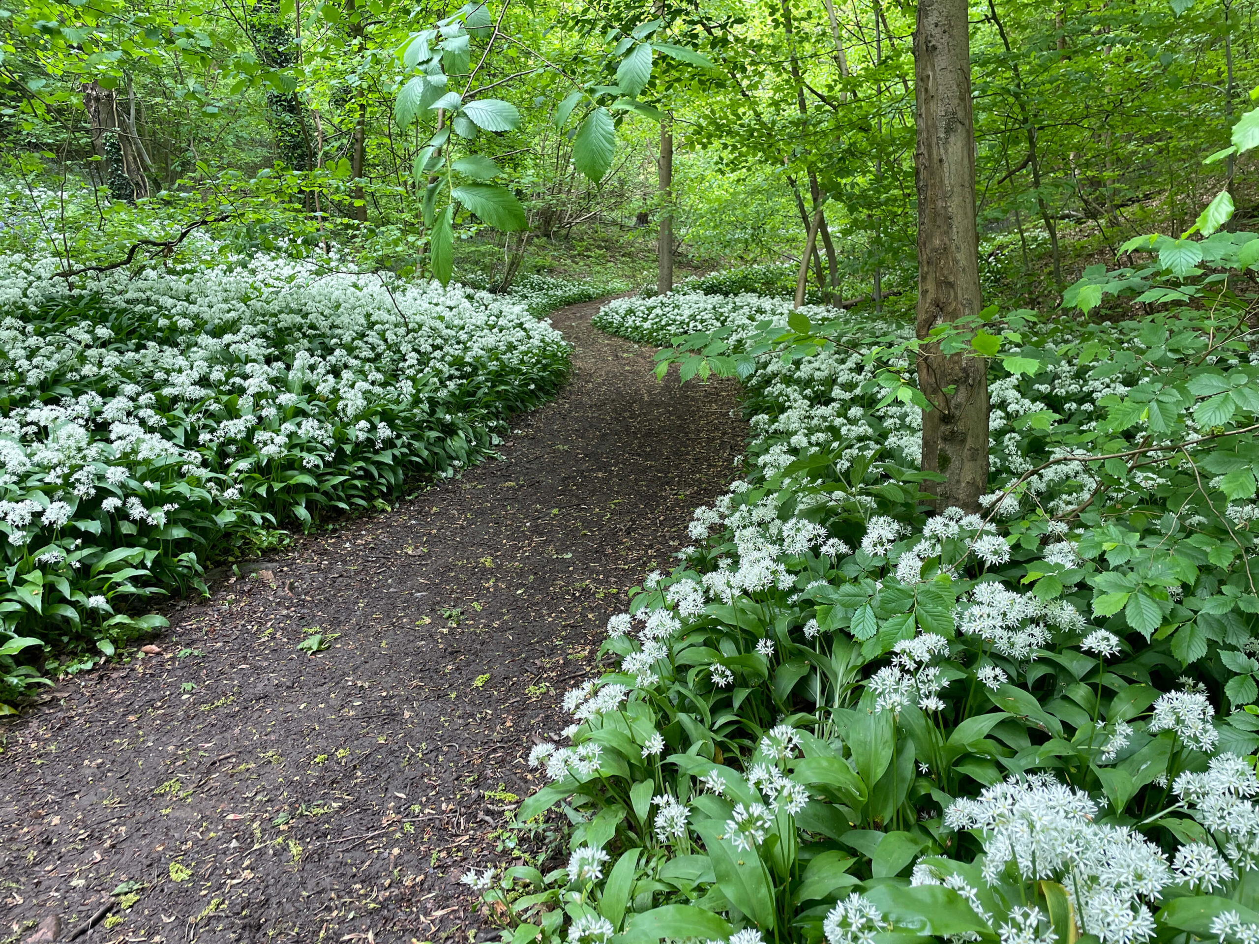
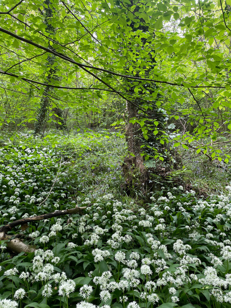
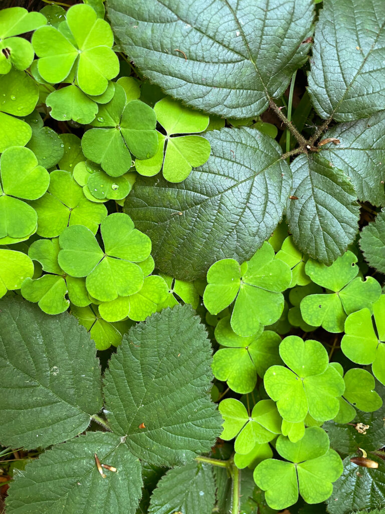
Wild garlic is the dominant spring wildflower in this part of Rollestone Wood. It grows underneath an alder, Alnus glutinosa, canopy. Both species indicate that this is wet woodland, a UK Biodiversity Action Plan Priority Habitat.
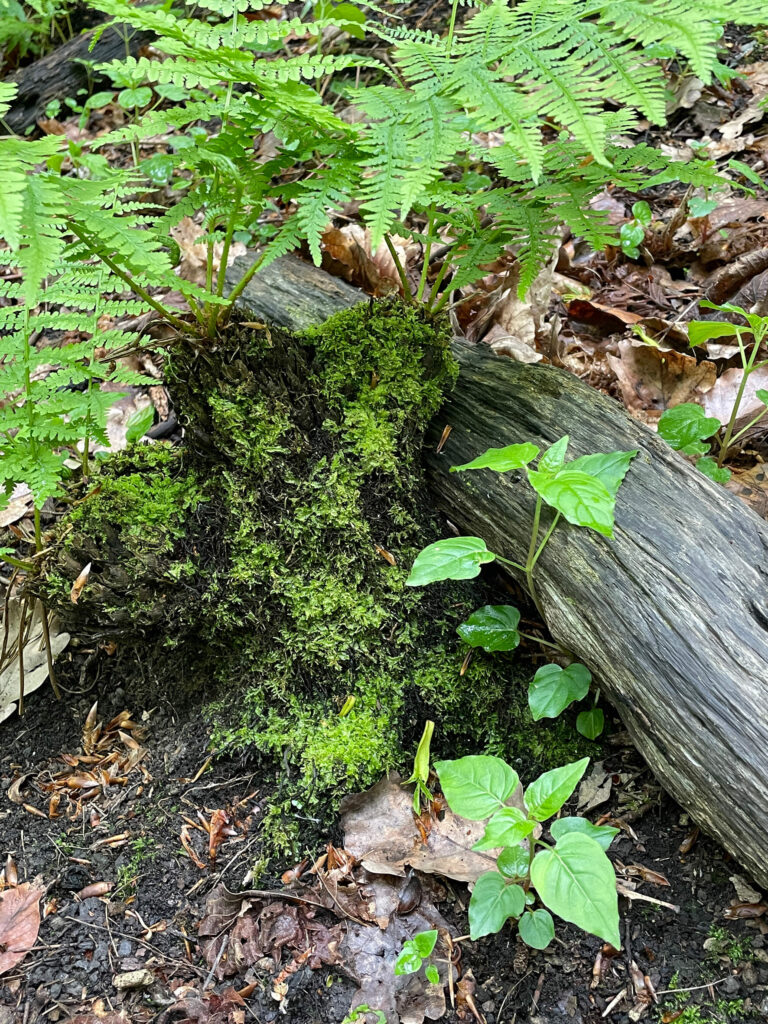
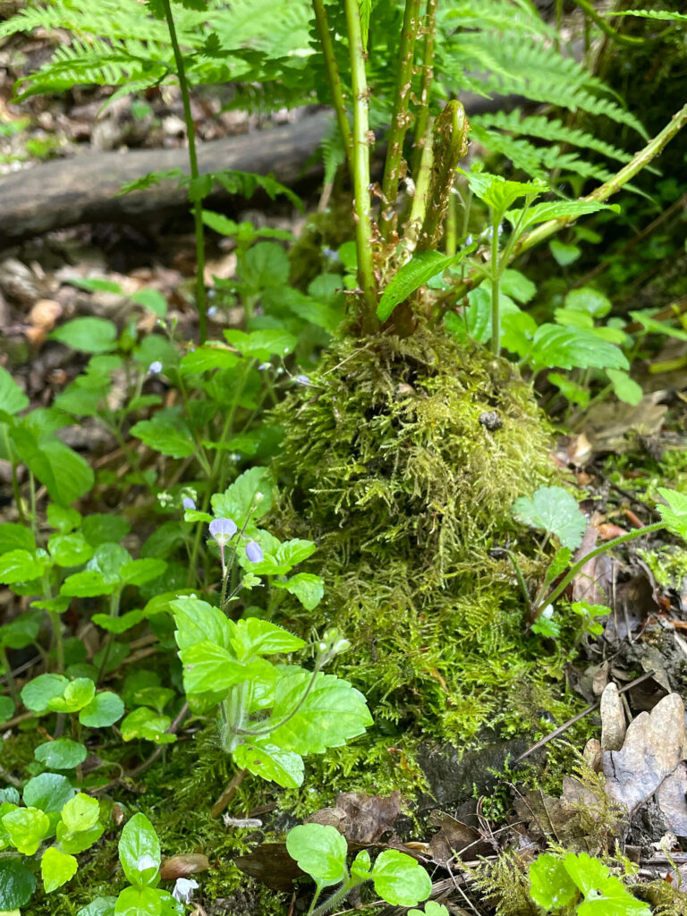
Other plant species benefiting from the moist soil include broad buckler ferns that have lived long enough to have developed woody bases, resembling miniature tree ferns. It is possible that these ferns are genuinely ancient. They grow very slowly and only become woody when they have reached a great age. This grows alongside Enchanter’s Nightshade, Circaea lutetiana, which prefer heavy, rich soils and are commonly found here.
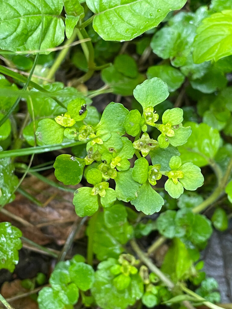
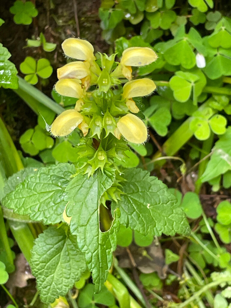
Wood speedwell, Veronica montana, is found growing nearby. This species has the typical mauve speedwell flowers, which are small in comparison to the leaves. Opposite-leaved golden saxifrage, Chrysosplenium oppositifolium, is a mat forming plant found in the dampest habitats. Despite its small size, its vivid yellow flowers are easily spotted against the rich green leaves. Both plants are ancient woodland indicator species.
Where the slope drains more freely, there are a few coppiced hazels that are good candidates for layering. This is a way of making new trees and rejuvenating an area of hazel coppice. Flexible hazel stems are partially cut through so that they can be bent and fixed to the ground. Where the stems make contact with the soil they will root and grow into a ‘new’ shrub.
Until 2014 overhead power lines above the steep slope meant the trees directly underneath were regularly cut back to protect the cables. This has had the effect of creating a coppice, primarily of sessile oak mixed with birch and rowan. Now that the overhead power lines have been removed volunteers can work in the area and a more systematic cycle of coppicing can be introduced. The slope has been divided into two woodland blocks or ‘coupes’ – coupe 1 & 2.
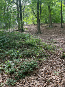
This coupe is a dense area of young multi stemmed trees dominated by oak, rowan and birch. An old beech trunk remains in place as standing dead wood, an essential habitat for invertebrates and a nesting place for birds.
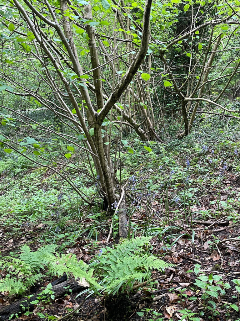
A colony of bluebells run diagonally down to the lower slope in this area to the stream corridor. Upslope from this there is a sparse area where moss, but little else, grows. This area will be coppiced again, all the way down to the streamside in winter 27/28. This will include some denser holly patches.

This area was last coppiced in February 2024 by Gleadless Valley Wildlife Trust volunteers and Council Rangers. It now has resprouting oak stools dotting the slope and rowan, birch, hawthorn and holly are all regenerating well here.
Brash produced from the coppicing work has been laid in lines, aka dead hedges, positioned at intervals parallel to the slope. These barriers retain leaf litter and other bits of fallen tree that would otherwise wash downslope during heavy rainfall events. This builds up a layer of organic matter that will slowly convert into soil. Which aims to restore the turf layer that was removed for use during the production of charcoal in earlier centuries. This process will be repeated for the sparsely vegetated areas in coupe 2. The depth and other properties of this accumulated soil will be quantified using sensors installed for the duration of the project and by taking soil samples at the beginning and end of the project.
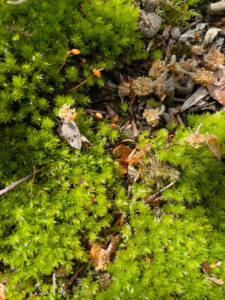
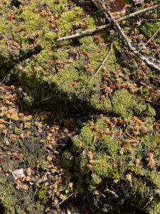
Where the soil layer has been stripped, fewer mosses grow. A mossy surface helps protect soil from erosion, making barer patches more vulnerable to drying out and being swept downslope during heavy rain. Where the soil remains intact, and with more light and plenty of moisture in the soil available, mosses grow luxuriantly.
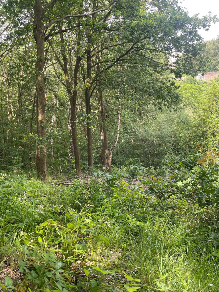
The photo below is looking across the coppice strip in the steep wooded valley to the residential tower blocks on Blackstock Road. This is the view from the top of the soil monitoring transect. The soil stabilisation described above will be taking place on the steepest and most eroded parts of the valley slopes. This view includes an oak ‘waver’, distinguished from its surroundings by the sunlight illuminating its bare trunk. A waver is a young tree nominated to become a future ‘standard’. A standard being a tree that is not coppiced and is allowed to grow into a mature specimen that would have been harvested for timber.
Typical woodland management in local woods from at least the 15th century was that of ‘coppice with standards’, providing a regular supply of ‘small wood’ or coppiced ‘poles’ interspersed with standard trees. The large standards were situated so as not to cast shade on the surrounding coppice. This worked well from a production perspective and created conditions highly supportive of a diverse woodland habitat with rich ground flora in areas where turfs were not being stripped.
“A document from 1462 refers to a number of localities in the Norton Parish, including Rollestone Wood, that were to be coppiced. The document records that John Coles and John Parker had been granted permission by William Chaworth, knight and lord of Norton,’...to fell…cole (i.e. to make into charcoal) and carye the said Woddes…’ preserving for the owner ‘sufficiaunt Waivers after the custom of the contre…’” (quote from Sheffield’s Woodland Heritage, Mel Jones, third edition page 15). These techniques of the past are now being reintroduced and adapted to conserve and improve biodiversity in the selected parts of Rollestone and Carr Woods described in this post.
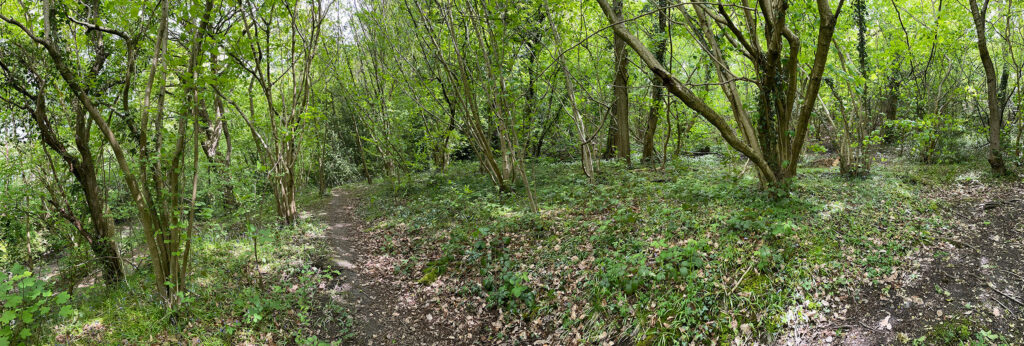
This second view is of the course of Monitoring Transect 2c-1, through an area adjacent to the coppice area 2c that has similar soil conditions but where no additional measures to halt soil erosion are being put in place. Soil monitoring is to be undertaken at a number of locations spread down the slope to the valley bottom and streambank. .

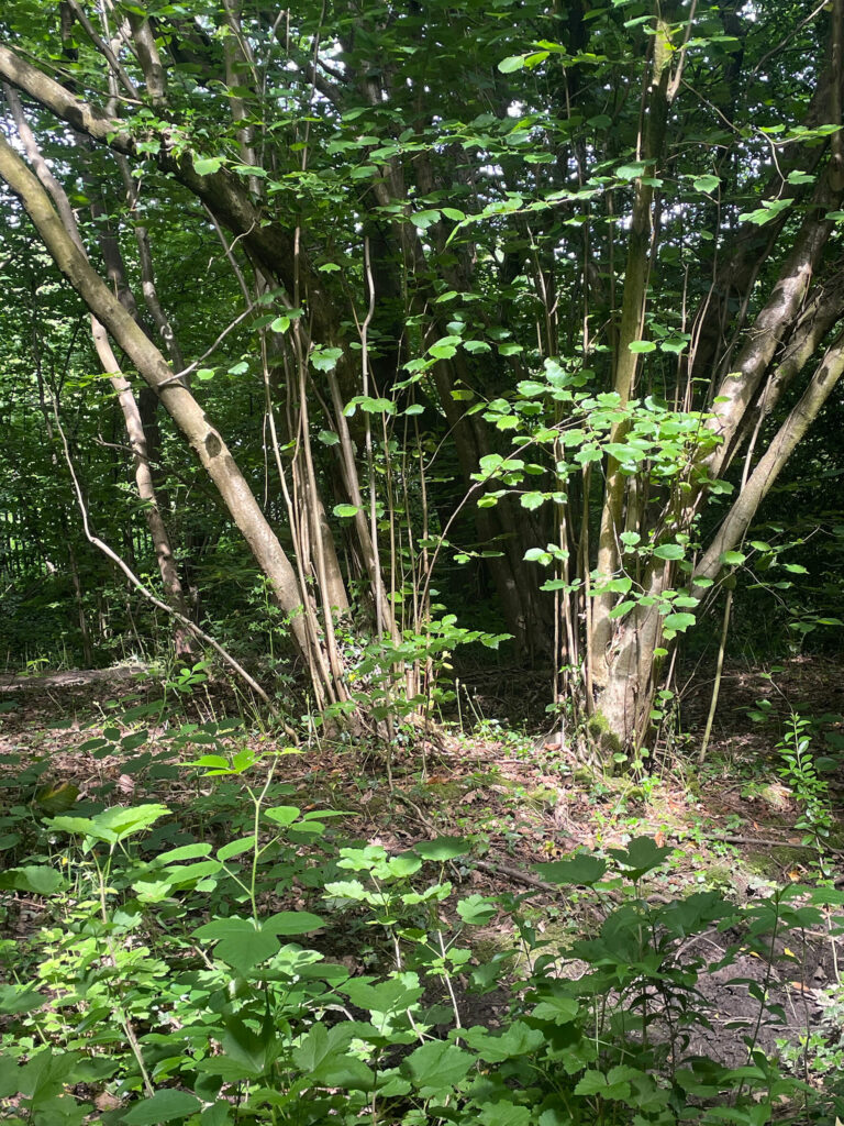
This location within Carr Wood has a small relict hazel coppice. The health of the hazel is good where it is situated under areas of more open upper tree canopy. Ideal conditions for the successful growth of hazel and other understory shrubs, which need plenty of light to flower well and produce the hazelnuts & fruits that are vital food sources for birds and small mammals.
Where hazel is growing under the shade of closely spaced sycamore, which has larger leaves producing a denser canopy, it is much less healthy. Trees regrow as more thin forms with less foliage and there is no lower shrub layer. Targeted removal of mature sycamore will take place here, leaving one dying sycamore as a standing dead wood habitat.
Further up the stream there is a species rich bank of wildflowers. Two ancient woodland indicator species, Wood sorrel Oxalis acetosella and yellow archangel Lamium galeobdolon, grow here but are sadly otherwise rare throughout the Gleadless Valley woodlands. This small pocket of biodiversity has been protected from passing footfall and other historic woodland activities by being on a slope directly above the stream. Where the footpath lies on the opposite bank, there is barely any vegetation left aside from that which is directly above the watercourse.
A little further downstream , where beech was planted during the 19th century on the steep valley side, the negative effects of changing the woodland ecosystem could not be more obvious. Just a few patches of creeping soft grass remain where once there would have been a slope covered in woodland plants. Where the grass roots have anchored the soil, it has formed a slightly raised island. All around the slope has eroded down a uniform profile which, without human intervention – the removal of beech and creating barriers to accumulate soil – there is no chance of any ground flora regeneration taking place. It would be possible to fell the beech and lay them along the slope contours, thereby making the cause of the problem part of the solution.
The following trees in Carr Wood have been recorded due to their historic importance. They are included as examples of historic tree management techniques and what they develop into when left unmanaged for decades or, in some cases, centuries.
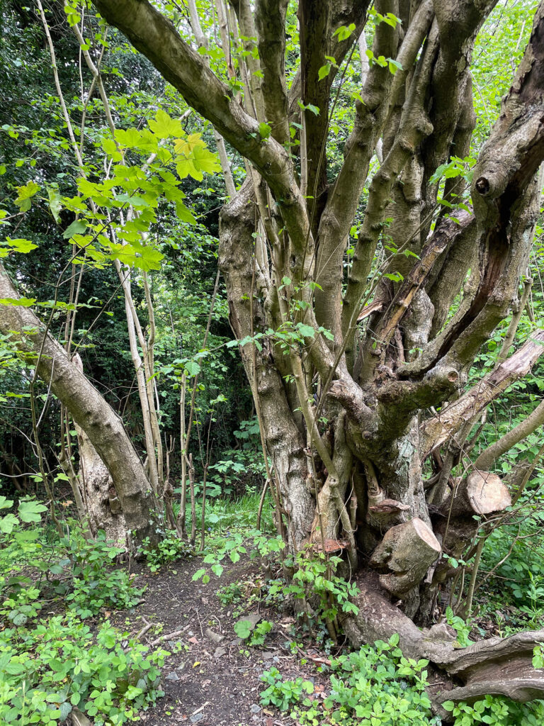
This extraordinary coppiced hazel near the northern tip of the wood is impossible to age. There is no single trunk to measure, which is how the age of trees is calculated (without cutting them down and counting the rings). Hazels that are regularly coppiced can see their lifespan jump from roughly 60 years to 300 years or more. What makes this specimen even harder to read now is that it is a partial ring, where the original central trunk has died leaving younger limbs to grow on. However many hundreds of years old this tree is, it is likely to be the oldest hazel in the Gleadless Valley.
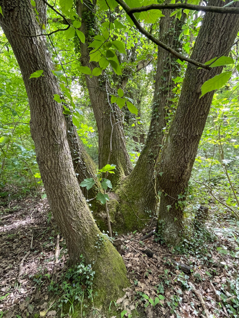
Near to the hazel and set back from the footpath a multistemmed oak grows, partially obscured by wych elm, Ulmus glabra, branches. The proper description of this tree form is that of a ‘lapsed coppice’. Where it was once cut on a cyclical basis before eventually being abandoned when there was no longer a need for oak poles for charcoal making or other purposes. The oldest oaks in this part of Britain are almost always lapsed coppice, rather than standards that would have been long since felled for timber. Again it is impossible to accurately age this tree, but it is likely to be in the region of 500 years old. Making it both the oldest oak and the oldest tree in the Gleadless Valley. The sycamore sapling trying to grow in amongst the stems will be removed.